San Elijo Overnighter

I have been planning and preparing for a week-long tour of PCH (Pacific Coast Highway) here in California, and this overnighter ride is, among other things, a shakedown for the tour. I have spent time shrinking my load to a minimum size and weight. Most tourers err on the side of packing too much if you read their blogs and social media posts. My weight weenie tendencies run deep: I wanted to make sure I did not eliminate too much. In the end I was happy with what I decided to pack. So much so that I think I will dedicate separate posts to gear and packing reviews.

San Clemente, the beginning and end of my ride, offers one of the best stretches of protected coast highway bike trail anywhere, which ends abruptly as you go south. But the ride through town is overall very nice and beach town-ey.

My route took me past the fabled Trestles surf area, which was hosting some big surfing event and warranted a slightly closer look.

Continuing south I passed through San Onofre State Beach and on to a dedicated bike path with views of the ocean on one side and a freeway full of cars on the other side.

After that was Camp Pendleton MCAS (Marine Corps Air Station). If you plan to ride across the base, bring a driver’s license (I don’t know about passports), a helmet, and be sure to register on the base’s website about a week before you come. If you don’t, you may not be allowed on the base, and the only alternate route is on the shoulder of the freeway, though that is not as bad as it sounds.

South of the marine base is the city of Oceanside. While it is definitely faster to ride across Oceanside without riding “the strand” beach trail, I was riding in touring/sightseeing mode. My tendency is to put my head down and hammer. But I did that the last time I rode PCH and discovered afterwards I did not have the kind of experience I was looking for. So this was not only a gear shakedown ride: it was a shakedown of my attitude as well.

My destination was the Hike and Bike campsite at San Elijo State Beach. It is a great option for a last-minute overnighter. It is definitely urban camping though.

There are almost always other riders to share the campsite with, making it a great way to meet people. This trip was no exception. I met Trey, a local rider doing something similar to me, and Anna and Amondine (I nicknamed her Mandy) from Belgium. They were traveling the world via a network of host households that offered travelers short-term employment so they could earn the cash needed to continue long-term but frugal travel.

Trey, intrepid local traveler.

Amondine and Anna, Belgian world travelers.

I spent the evening sharing my extra food, wine and whiskey, learning about how to travel the world and speak French, stargazing and imagining people on other planets looking at us and our star millions of years ago.

San Elijo is a rare urban / beach camping locale but it is not without its cons. Train tracks parallel the beach  and a few trains come through at night, sounding their very loud horn for an intersection right across from the campground.  But I have learned to deal with it. I bring ear plugs. While I am at it, I bring eye shades for headlights from cars on the road. They have become staples I bring with me on all camping trips. You never know what kind of camp site you will end up with. And getting a good night’s sleep is one of the most important things for me when bike touring.

I am a bit of a morning person, so I woke up and watched the “dawn patrol” surfers in the area for a while.

Back at the campsite we said our good byes and shared well wishes with each other as we packed and went on our separate ways. Next on my agenda: seeking out my morning elixir.

The ride home was a rewind of the ride there, but with a mild headwind instead of a tailwind. I can pass a lot of things while riding, but a good Mexican meal is not one of them.

My bike, loaded for the ride and parked for lunch. It will not need much more than this for the big tour.

Overall the ride was a success. I am looking forward to a week on the road in May!

Elapsed Time Moving Time Distance Average Speed Max Speed Elevation Gain Calories Burned
03:55:59
hours
03:14:10
hours
44.11
mi.
13.63
mph
36.69
mph
1,282.81
ft.
1,196
kcal

Relive ‘Lunch Ride’


Elapsed Time Moving Time Distance Average Speed Max Speed Elevation Gain Calories Burned
05:27:26
hours
03:45:36
hours
44.81
mi.
11.92
mph
31.09
mph
1,584.65
ft.
1,191
kcal

Relive ‘Morning Ride’


Redlands Strada Rossa V 2018: What A Difference A Year Makes

I rode the Redlands Strada Rossa ride last year (RSR IV) and really enjoyed it, so naturally I was looking forward to the event this year (RSR V). I registered early and reached out to the event organizer and produced a virtual flyover of the 67 mile route, such as it was planned at the time. It later changed a little. But no one uses the flyover for navigation. And BTW, pay no attention to the “IV” on the bird logo. The flyover is indeed of the “V” ride. It has a soundtrack, BTW, but I think it is muted by default, so use the volume slider and crank it up.

Details of the route that I took are below. I modified the course beforehand since I wanted something between the 33 and 67 mile options. The ride organizers put the course on ridewithgps.com so it was easy to edit the course and download it to my trusty Garmin GPS. It was a ride not a race: cutting the course does not get you disqualified.

The weather forecast leading up to the event had me concerned. I was looking at it several times a day and the predictions kept changing. Redlands was getting rain, so who knew what the trail conditions would be by the day of the ride? The changing forecast usually called for rain on the day of the event. The ride was a “rain or shine” affair. Since the event organizers were willing to press on regardless, so was I. I packed my rain gear and was ready for whatever nature threw at us.

I left early the morning of the ride. That would have worked out great were it not for the unexpected traffic and freeway ramp closure or two. Alas, GPS navigation can only help so much. I encountered rain on the drive as predicted. But the forecast had changed yet again and called for early morning rain then clearing in time for the ride. Spoiler alert: they were right. The weather for the ride was one of those post storm days where the air was clear, the sky had a dramatic mix of moving dark and bright clouds, and conditions were changing enough to give you a feeling of adventure without ever getting rained on.

A unique place called “BikeBBQ” hosted the registration and start line. They are a non-profit community resource for bike repair and education. I encourage you to do a web search for them in Redlands. I hope for their success and the proliferation of places like theirs. It could ignite a big increase in bike use.

BikeBBQ (or Bicycle Barbeque, or whatever) is an unassuming place with great potential, and host for the registration of RSR V.


A quiet start/finish line between mass starts in the very hip Downtown Redlands district.

I arrived at the start line late: in between in the start times for the 33 and 66 mile routes. That seemed OK since my custom course length was between the two. The course wound its way onto a dirt path in short order, then out onto the flood plains north of Redlands, where the clouds occasionally parted to reveal  snowy mountains, sunshine, and views of the big rugged landscape of the area.

The size and view of the flood plain was pretty dramatic.

As for the trail conditions, my concerns about unridable muck quickly evaporated. Unlike the clay soil where I live and ride, the dirt in the Redlands area is mostly gravel, sand, decomposed granite and other materials that drain quickly after a rain. Having ridden similar trails in dry conditions a year ago, I would say the trails were just as rideable, just different, the day after a rain. You traded  a few small sandy sections for a few small muddy sections.

Approaching SAG stop #1


Shenanigans at the first rest stop


Greenspot Road Bridge is historic, well preserved and as iconic as ever

The bridge used to the main road back in the day when there were far fewer cars. Now it is a dedicated bike trail bridge.

The new bridge is just, so, well, you know, new.


Yes, I put my own pic in my blog once in a while

By the first rest stop I had completed my first course shortcut. I had been riding with a couple of other stragglers like myself. The shortcut allowed us to catch up to the main group of riders who started before us so it felt like being part of a big event again.

The ride up to SAG 1 was a good warm up for the climbing that followed. The course took us up the hills behind the bridge, which ascended with a pretty aggressive grade. The looseness of the mud here and there added to the challenge. Then came the rolling hills with a few short down/up sections. Normally I would take the down as fast as I could handle and carry as much momentum as possible up. But the looseness of the trails meant I could not descend as fast as usual, so I had to work more coming up the other side.

I took a break after this steep down/up section. I watched a lot of riders walk the whole thing. I made it more than halfway up the other side and only saw one rider clean it.

Between my Garmin and the course markers the route was well-marked and easily to follow. For me anyway. There was more than one intersection where I used all the navigation aids available and stayed on the course while I heard and saw other riders leave the course, then find their way back.

Kudos to the ride organizers for laying out and  marking a great course:

  1. They used some clever, consistent ways to mark the trail. They used colored arrows to mark the course depending on which route you chose. They used bright, long orange strips that were aligned with the direction of the route; very helpful at multi trail intersections at odd angles. And they used low plastic cones which provided visibility and were not moved around by the elements.
  2. They did not go overboard with trail markers, which means using less plastic, which is greener. A printed route slip and/or a GPS track to follow should be the primary tool used by riders. Trail markers are a supplemental navigation aid and should not be relied on alone. Markers can get blown away, stolen, covered when people ride over them, carried away by the rain. etc.
  3. They provided a GPS track that  was a great resource that made course transitions clear and easy to follow. It was accurate enough that you could zoom in and figure out which side of a gate to go around, which of two close parallel routes to take, etc.

In a time of increased environmental awareness, I would hope that some day we can have GPS only rides. Course markers and printed ride slips are waste we can do without. I know that not everyone has, likes, knows how to use, can afford a GPS or whatever. But there are concessions we need to make and changes we need to accept in order the help the environment.

While the race organizers had official SAG stops along the ride, there were also other places where riders would collectively stop and take a break. The Mill Creek Visitor Center was one such spot. There were a lot of riders from out of the area on the ride, so many of us were not familiar with the local trails. We were admiring the course up to that point and trying to figure out what came next.

Spontaneous rider meeting spot, featuring a beautiful red bike in the foreground, don’t you think?

From the visitor center we could see a trail on the ridgeline of a mountain that seemed to be in the direction of the course. It represented many hundreds of feet of climbing. We all had the same reaction. “Oh no, the ride is not going there, is it?” Short answer: yes. Yes it was.

The ridgeline road to Zanja Peak, visible just below the top of the mountain. See it there?

I left the visitor center and headed for the mountain. As sometimes happens, one person’s departure makes everyone else realize that they have been hanging around a long time and it is time to get riding again. I heard the group of riders get started behind me. I thought they would all be passing me on the long climb. But much to my delight, they did not. I held my own in the large pack as we ascended the trail. In some cases my navigation skills helped because not everyone stayed on the course. But whatever the reason, I was happy to stay in the group.

The climb to Zenja afforded some inspiring views

By the time I reached the peak I needed a break so I stopped and I let the group continue on without me. There was even a bench along the side of the trail (sponsored by a local bike shop) so you could enjoy the inspiring views in comfort.

The course had taken us across the wash below


The shadow of a cloud cast on a valley carved by the water flowing off of a mountain over geologic time puts things in perspective.


I am a sucker for panoramic shots. I know they don’t work very well, but I remember the experience that went with them, so lets just say they are for me.


The panorama, shown as a video. Kind of a neat option I say.

The descent down Zenja was a fast fire road blitz. I don’t usually talk gear in my blogs, but my Salsa Cutthroat with a custom build flew down the mountain, confidently taking switchbacks and sweepers.  I have gotten comfortable staying low in the drops most of the time on the bike, which goes against the trend of upright riding positions on mountain bikes, but the position offers great control and traction.

The attack on Zenja Peak kind of took it out of me. I was ready to take an easy ride back to the parking lot. But that is not what the 66 mile route called for. It is not even what my shortened 50 mile route called for. So I busted out the Garmin and told it to navigate me back to the start by the shortest route. Happily it was almost all downhill. My rear tire, set up tubeless, had started to lose air very slowly. I decided to live with it rather than install a tube. I took it easy on the descents as the back of the bike disagreed with the front about which way to go. And by the end, even with my creative course routing, I got in a good long ride.

Elapsed Time Moving Time Distance Average Speed Max Speed Elevation Gain Calories Burned
06:33:49
hours
04:53:10
hours
43.04
mi.
8.81
mph
35.12
mph
3,812.34
ft.
2,734
kcal

Relive ‘Redlands Strada Rossa modified’

Unfortunately my schedule did not allow me to hang out at the race finish, but there was food and a big get together.  I bid adieu to the Strada Rossa and hit the road. I look forward to riding again next year.

Mud Bogs and Seaweed Clumps

I like to call my fat bike a surf bike. It is not a perfect name, but it conveys what I like to do with it, which is ride on beach sand. A properly set up fat bike can ride along the beach all day in the right conditions. What are the right conditions? One factor is the kind of sand. Sand that is too coarse or gravelly is no good: you sink into it no matter what. The finer the sand the better. Another condition is the wetness of the sand. If you cannot walk or run on the sand long, you cannot ride on it long either. People who run along the beach are good examples of what you want for fat bike conditions. They run on the wet sand just beyond the reach of the waves. If you ride along the ocean, the last condition is the tide. You want to ride on a low tide, or at least a falling tide well after high tide. At high tide  or during a rising tide the rideable wet strip has waves crashing on it all the time. The timing of  these conditions not been good for the last year or so. Good low tide conditions have been occurring at night and/or on week days. But now there are good fat bike beach conditions forecast every two weeks for many months. Consulting the tide report is very important when planning a surf bike ride.

The bikes that surfers ride might better be called surf bikes. Many surfers have beater bikes with surf board racks, and  they walk them out onto the sand to go surfing. There is also the recent trend of eBikes with fat tires that you might call a surf bike.  Surfers cans save their energy for surfing and they don’t have to push them across the sand. Fat eBikes outnumber human-powered fat bikes around here by a wide margin when you count those that are ridden by non surfers on the bike trails and streets. I would not consider those to be surf bikes, but they would probably get lumped into the category, if it actually existed.

But whatever you call it, I rode the fatty along a route that I have been riding on my gravel bike lately, but threw in some beach sand. At least that was the plan.


Elapsed Time Moving Time Distance Average Speed Max Speed Elevation Gain Calories Burned
06:45:01
hours
04:11:45
hours
35.96
mi.
8.57
mph
25.72
mph
2,408.14
ft.
2,131
kcal

Relive ‘Big fat fatty loop’

A dedicated pedestrian / bike bridge

I started with the big climb needed to get access to dirt trails where I live. My route took me past the amazing pedestrian/bike bridge that spans a new street. The bridge does not carry vehicle traffic: there are only hiking/biking dirt paths leading away from either end of it. But I have the same reaction every time I see that bridge: it is an unnecessary extravagance. That thing most likely cost millions of dollars to build. I cross the street that is spans less than a half mile from the bridge at a traffic light.  If you are going to count that as cycling/pedestrian infrastructure, the money would have been far better off spent to improve bike lanes, make bike paths, etc. If you are going to count that as a welcome sign for San Clemente, you could make a nice one for much less. Think of the iconic welcome to Las Vegas sign. Sure, that is not our style here in San Clemente, but it represents a lot of bang for the buck. OK, flame off.

It had rained a few days before the ride and that was enough to dry out all but the worst clay mud bogs. In fact, I encountered only one muddy patch on the ride. So I made sure I to take lots of pics.

If you get stuck in the mud, at least take pics.


It was the only mud bog of the day


Obligatory fatty glam pic

For this ride I decided to take the fire road option through the San Clemente Singletracks area,  which seems an odd choice in an area named after its singletrack riding, but it climbs to an overall higher point affording a pretty good view of the charred valley below.

Panoramic photos never capture the view like you hope they will, but I have to try them once in a while nonetheless

With a great climb comes a great descent. And this one ended at Trestles beach. I continued south past the decommissioned nuke plant at San Onofre and on to San Onofre State Beach. If features some quirky and little known mountain biking, closely paralleling the paved road that runs the length of the park. It also offers up ever-changing views and the occasional technical twist in the trail.

Sunlight dazzles on the surf

But the feature of the day would be the beach section, starting with a drop in to “Old Man’s”. My timing with low tide was good, I was able to ride out in the tide pool areas. My spokes collected seaweed even better than the tires glommed onto mud and sand.

Your bike might be a surf bike if the spokes and crank get full of kelp.

The final leg of the ride proved pretty tough. I was recovering from a cold and 36 miles of fat bike riding was proving more than my body was ready for. My cold was mostly gone, but it was my stomach that was unable to keep up the pace. Let’s just say it would not be prudent to go into more detail.

I have lived in San Clemente for over 20 years now, and its beauty can still take me by surprise, coming up with postcard scenes in unexpected places even for jaded residents.

A classic San Clemente scene


There is not usually a flotilla of sailboats here, but these posed beautifully in the dazzling light of the reflection of the sun off the ocean.

Back on Coast Highway I was focused on getting home. But not too focused to stop and talk to one of the many people you see engaged in a loaded bike tour along the coast. I talked to Arthur (pronounced ar-TOOR) from Lithuania. He had ridden from San Jose to Ensenada. From there his riding buddies continued on to Mexico City and he turned around and headed back north. I told him about my plans to do a PCH ride starting in San Jose also. Arthur chose to strike this triumphant pose when I snapped his pic.

Arthur (pronounce it ar-TOOR) from Lithuania.

I did finally make it back to where the ride began: my front door. Somehow I managed to come up with a very small second wind and complete the climb into my neighborhood. Favorable fat bike ride conditions will return (for a working stiff like me) in another two weeks. I hope on that ride I can get a little more surf riding of the human-powered two-wheel variety.

The Great American Eclipse Trip and Boise Bike Tour, August 21 2017

Preparation and Getting There

I don’t know when I first heard about the Great American Eclipse of 2017. We know the schedules of eclipses for centuries in advance, maybe longer. I may have heard about it back in the 70s in high school (yes, now you have a bracket on my age). But I had never given much thought to making a trip to see a total eclipse. Carly Simon made it sound like a character flaw to see the total eclipse of the sun, after all. That all changed after I read the information about the eclipse that started flooding my social media. There is no comparison between a total eclipse and the partial eclipse that I would experience if I stayed home. I started reading about the crazy effects that occur during a total eclipse and I was hooked. I decided to travel to a viewing spot near Boise, Idaho and experience it in person.

At first I was not going to make a blog about this trip. I had decided to take the trip on 4 wheels, and, well, you know the title of the blog as well as I do. I have a motorcycle that would have been capable of taking me there with no problem. But the route involved crossing the desert for days in August. So I opted for my 4 wheel air-conditioned  conveyance instead. I also decided to camp along the way to keep the feel of a two-wheel trip. For quick overnight stays during travel in good weather I prefer camping to cheap hotels. Even in desert heat, overnight lows were forecast to be temperate for the trip. But I decided the trip fit my blog because part of the reason I chose to see the eclipse in Boise was to check out the city. It is a place I am interested in relocating to because it is known for its cycling and outdoor lifestyle. So part of my agenda was to rent a bike when I got there and ride the Boise River Greenbelt bike trail and get to know the area by bike. That sounded like 2 Wheel Lifestyle stuff, eh?

I found a map of the path of totality through the area and I chose Mann Creek Country Store as the place to view the eclipse. It was almost exactly on the center of the path and it was a long way from anything. After a couple of phone calls I found out that they were expanding their small campground just for the eclipse and they would have extra food, live music and other festivities. It was perfect. As long as it didn’t turn into “Eclipsing  Man”. And there would be no way to know that anyway.

My destination

As the eclipse drew closer I began reading dire predictions of what could happen during the eclipse. Most of the country lived within a 1 day drive of it. If they all decided to go, it would be a logistical nightmare of gridlock, overloaded emergency services and infrastructure. Undeterred, I decided to arrive early, leave late and bring extra supplies. Camping  would help me deal with a worst case scenario too.

After months of planning and anticipation (far more than was needed), I finally hit the road. My route took me up highway 395 in California, which I have always found remote and adventurous and I never seem to tire of it, even after spending a few years driving it frequently for business.  I stayed the first night in Bishop, CA.

Camping in Bishop, CA


Obligatory food pic. I always seem to be cooking and eating dinner in the dark when I camp.

There are several different definitions or categories of “camping”, something that Google with all of its technical prowess cannot seem to deal with. There is at least: RV camping, car camping and backcountry camping. Bicycle and motorcycle touring fall between backcountry and car camping  in terms of the gear you use and where you go, and they are my favorite format for adventure. So a car camping trip like this was a real luxury. I got to use a big 2 person tent for just myself, which I referred to as my “condo”. I brought an expansive 2 burner propane gas stove. A cooler and always present ice was something that I really enjoyed. I spoiled myself by not worrying about bringing extras or duplicates of clothes, food, etc. Such opulence!

As I was driving I noticed other people headed for the eclipse. How could I tell that was their destination? They had signs in their windows! It was so totally nerdy that I got inspired and pulled over at a drug store and made a sign of my own so I could fly by geek flag at full mast.

Owning the tech-dweeb spirit. There was no point in fighting it.

By night 2 I had reached Boise, just a short jaunt from the Mann Creek. I stayed at another RV/tent campground. Tent campsites at RV campgrounds are usually leftovers after allocating all of the good spots to the RVs. This campground was no different, but at least the tiny campsites were waterfront locations.

My home for two different nights, but not in a row

The Main Event

I struck out early the next day to explore Boise a bit before continuing to Mann Creek. Boise is a lovely mix of urban and rural, old and new, big city and small town.  I felt like it was a mix of the small farm town I grew up in and the big city I have since moved to. It ticked all the boxes for me.

Old local architecture is well preserved and gives Boise a rugged western feel.


Boise is growing pretty fast from what I read. It seems to be doing it with balance and poise.

I only took time to have a cup of coffee and have a quick look around Boise. I would spend more time there after the eclipse. It was time to head out to my chosen viewing site early just in case the rest of the state decided to show up at the same spot. There was no way to know who would show up where.

The state was somewhat prepared for big crowds. And yes, I parked on the highway to take this picture.

The crowds and heavy traffic did not really materialize. In my travels the small village of Weiser had some small traffic jams. It was fun driving through the small town with RVs parked and tents pitched all over the place. I arrived at Mann Creek shortly afterward, and they were ready for the eclipse. They had live music, plentiful beer and barbecue, beach volleyball and a generally festive atmosphere all good to go.

Mann Creek had food trucks, kiosks and a lot to see.


I took a break from cooking my own meals at campsites.

I set up camp in a field that had just been cut to create a makeshift camp area. The grass had the texture of sticks and many people were complaining about small bugs covering their lower legs as they walked across the field. The site did have a couple outhouses that had external sinks with soap, water and paper towels, but that was it. I felt well prepared and ready for the eclipse the next day. I had even thought to bring a small folding chair, which was very important at a site like this.

No picnic tables, fire rings, electricity or water at this “campsite”. But I was happy with the location nonetheless.


Another look at the extravagance I was basking in at my campsite.

The next day was the big one. I had read many times that taking pictures of the eclipse was best left to NASA and the professionals. The total eclipse would only last 2 minutes 20 seconds or so. It would be better to spend that short time experiencing the event rather than focusing on your camera then looking at it through a lens. Many of my campground neighbors were taking the professional photography approach with big telescopes and nice cameras made for taking these kind of pictures. I could not help it, I had to take a couple of pictures, but I decided to limit it to just that. I used my phone with a sheet of “opaque” Mylar to attenuate the sunlight. It is the same stuff I use on the top edge of my motorcycle helmet face shield, so it seemed like it would work for this application. It did, but one one picture I took before the eclipse began was enough for me.

I had to try. It does look kind of cool though.

One effect I had hoped to see during the eclipse was the shadow of the moon racing toward me  just before the total eclipse started. The shadow was moving at 1600 mph or so, so you needed to get a view of a large area in order to hope to see it. Those who have seen it describe it as and awesome and even frightening effect to behold. In order to see it I needed to find a high vantage point where I could get a good view. Fortunately one was nearby.


The view of the “campground” from the hill were I watched the eclipse.

I was not the only one hoping to see the shadow of the moon approaching. I made a few new friends at the top of the hill, and it turns out we were all there hoping to see the shadow of the moon too.

Rachael, Randy and Greg came from the UK and Northern California to watch the eclipse.


As we waited for the eclipse, a party raged on at the cafe below sending live music our way as a soundtrack to the event.


The was the view we had in the direction that the shadow of the moon would be coming from.

In the last few minutes leading up to the total eclipse, things got really weird. The light from the sun was dimming noticeably. It was very strange to have the sun overhead on a clear day but for the day to get dark anyway. It was like the light of the sun was more like a silvery or gray moonlight effect. For my group on the hill looking for the shadow, it was a bit of a commitment. You had to be looking at the ground to see the shadow, which means we would miss the onset of the eclipse and the first diamond ring effect. But those would happen again in reverse order at the end of the eclipse, and the receding shadow of the moon is not an effect to watch for anyway.

The eclipse finally started, cheered on by the crowd at the cafe below. But none of us were able to see the shadow of the moon effect. The dimming of the sun suddenly turned into night in the middle of the day: no advancing curtain of darkness.  I think we needed a view of a larger area if we wanted to see the shadow. So it was time to look up at the eclipse itself. Even after all the hype and preparation and pictures, I was still unprepared for what I saw when I looked up.

Another example of how I had to try to take a pic. Compared to the real thing, it did not capture it at all.

It is hard to describe what the eclipse looked like, but I will say that I have never seen a picture of an eclipse that captured what I saw that day. The sun was replaced by an impossibly dark disk, and the corona stretched out with arms of light about the intensity of a full moon that covered a huge part of the sky. The sky went dark and a sunset effect took place 360 degrees around the horizon. The temps dropped immediately by what seemed like 10 degrees or more: a warm August day suddenly turned into cold unnatural sunset. I thought I had become jaded about all of the amazing things that would happen during the eclipse after reading about them so much. But even after all of that, it still blew me away. I took one last pic: a video actually.


The eclipse ended with an astounding diamond ring and the re-emergence of the sun, greeted by another round of cheering from the cafe. All of the strange dim light from the sun that took place before the eclipse happened but in reverse, steadily returning to a normal day as if nothing unusual had happened.  I waited a long time before I broke camp hoping to avoid traffic, but not too long, the partial eclipse was still ongoing. I encountered more traffic leaving that I did getting there, but I expected that. People trickled in all morning, but tended to leave at the same time. A little creative use of Google Maps did save me some time. The eclipse was over. It was time for what I was calling my post eclipsolyptic bike ride in Boise.


Out and About in Boise

I rented a bike from a shop just north of downtown Boise that had good access to the Boise River Greenbelt and rode south on the greenbelt as far as Eckert road and back. It was a great place to ride.


There was more to do along the river than bike.


There were beautiful homes, golf courses, parks and office buildings along the river too.


I could spend all day in a yard like that. Well, probably not actually. After looking at the bike trail I would be on my bike eventually.


The trail has many dedicated bridges that cross the river and its branches


This is like an artificial white water feature. It is calm in this pic, but it can release a lot of water too, making a challenging current to paddle into.


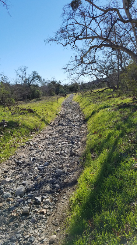
The trail is not all along groomed, landscaped grounds. There are wild areas like this too.


I stopped for lunch at Lucky 13 restaurant which I highly recommend. The spicy pizza was good enough that I had them wrap up the leftovers and I took it back with me, even though I did not have a good pocket to carry it in.


This part of Idaho does have a wine district, so I sampled a local vintage. I am afraid I may have been too cheap, though. New rule of thumb: when sampling local anything, don’t be stingy.

The Trip Home

The time had come to say good-bye to Idaho and head home. I really enjoyed my stay. I took a different route back, taking me through Las Vegas, where I sought out some Route 66 as an alternative route between Vegas and Los Angeles.


Huge river gorges like this were pretty amazing to see on the way back.


My last night camping at a tent site in an RV campground.


I finally checked into a hotel in my travels. Weekdays in Vegas can be a pretty good deal. And you just don’t get any Elvis statues at your normal campground.


This is the only time I have traveled Route 66 to get back from Vegas, and what do I stumble on except the iconic Roy’s Motel. It is not in business, but it is maintained as a landmark nonetheless.

The Great American eclipse had not disappointed. Total eclipses happen on the Earth somewhere about every 18 months on average, but this total eclipse ended a long dry spell decades long for the continental US. Now that I have had a taste, I want more. The eclipse in 2024 will be a destination for me for sure. While the eclipse did not result in the disastrous crowds it was predicted to do, I predict the 2024 will, now that so many people like myself know what they are all about.  I will review the path of totality for that eclipse and pick another viewing location with good cycling in the area.

The Strand On the Los Angeles Coast to Sycamore Canyon Overnighter, July 2015

The Plan

This is another throwback blog of a ride I took a while ago.  The route was simple: to ride the entire length of “The Strand”, continue along  Pacific Coast Highway (PCH) to Point Mugu State Park and camp at a Sycamore Canyon, then retrace my route back the next day.

Elapsed Time Moving Time Distance Average Speed Max Speed Elevation Gain Calories Burned
07:15:28
hours
04:57:44
hours
52.86
mi.
10.65
mph
33.33
mph
1,476.38
ft.
1,236
kcal
Fully loaded bike camping trip, Redondo to Sycamore Canyon. Mild headwind steadily beats you down, but knowing the return the next day would be a tailwind helps.
Elapsed Time Moving Time Distance Average Speed Max Speed Elevation Gain Calories Burned
06:08:09
hours
04:36:07
hours
51.90
mi.
11.28
mph
40.04
mph
1,385.83
ft.
1,735
kcal
Return trip of self supported overnighter camping trip on the fully laden touring bike. I originally posted this as two different rides but I found a way to combine them into one.

“The Strand” is the name of the paved beach bike trail along the Pacific coast west of Los Angeles. It has been given the official name of Marvin Braude Bike Trail, but I have never heard it called that. Although if you want to look it up on Wikipedia, use the formal name. The southern end is in Torrance and the northern end is in Pacific Palisades. In many sections there  are two paved trails: one for bikes and one for pedestrians. The Strand takes you past many famous places you have probably seen in movies and TV many times. It takes you under planes taking off from  LAX International airport, it gets routed onto surface streets in a few sections, cuts inland around Marina Del Ray Harbor, and is in general a great touristy ride. You should not be in a hurry along The Strand. In addition to all the sights to take in there are lots of beach cruisers, children on bikes, pets on leashes, rollerbladers, etc. that can wander all over the trail. It is best to slow down for traffic and enjoy the scenery for most of the 22 miles.

I chose to ride on July 2-3 for a couple of reasons. It was easy to get time off of work around the 4th of July holiday. And I had hoped that there would be a good level of beach activity at that time, i.e. not too much, but not abandoned either.

Getting Started

I drove to Palos Verdes to an area where it looked like it would be safe and legal to park overnight. It turns out it was: I did not get any tickets, towing, theft, vandalism, etc.  I wanted to ride The Strand from end to end, and it began with a relatively steep drop from surface streets to the trail and a cute place called Perry’s Cafe and Beach Rentals.


Perry’s Cafe was my welcome to The Strand

Perry’s set the tone for the entire Strand. There are hundreds of great places to stop and eat. You could spend days to cover The Strand if you wanted to. I planned to have lunch at one of the places that was right on the sand where I could stay in my bike clothes and sit outside.

El Segundo Beach Cafe is where I chose to stop for lunch

Even though I got a later start than I wanted, it was still too early for most beach goers and the trail was not heavily traveled. It made for smoother sailing but fewer people watching and sightseeing opportunities. There was almost no one at muscle beach, for example. The timing of Day 2 would be better for beach hubbub.

The Transition

Will Rogers Beach marked the northern terminus of the trail where I got dumped unceremoniously onto  Pacific Coast Highway or PCH. It was time for a complete shift in my riding attitude. There is a bike lane and room for bikes along this stretch of PCH, but there is a lot of parallel parking along the road, driveways and drivers who did not want to give me the space I needed to ride. I stuck it out, and the farther north I went along the road, the thinner traffic got. Making it through and past Malibu was a turning point, but it came at quite a price. The hills of Malibu were steep and plentiful, and my touring gear weight made them even tougher, of course.


Taking a break at Legacy Park in Malibu

I stopped at the last place available on the route to buy food so I could get something to make for dinner at the campsite later. It was a small high-end grocery where I was able to get a nice steak and a Starbucks was located in the same plaza. That is where I discovered I was not as prepared for the trip as I thought I was, financially anyway. I had lost my main credit card a few days earlier, so I brought along my gas credit card as a backup and some cash. It turned out the gas card was not a credit card at all and I could only use it at the one brand of gas station. I had no ATM access either so I made do with the cash I had, which was barely enough if I skipped a couple of luxuries I was planning on. I did have my phone and Starbucks app, however.

Stopping for a Starbucks at the last opportunity for civilization on day 1

Two Ends of the Spectrum

While at my final stop before camping, I encountered a slice of Malibu in a nutshell.


It is cool of you don’t think about the details too much

The pic may not capture it, but in person the Mercedes had a Barbie toy paint job. It was being driven by a teenage girl and the SUV was obviously hers. She may have been a child star with the means to pay for something like that herself. Or it may have been a gift from her parents. But either way, having that much stuff at that age is usually a recipe for disaster. Call me jealous if you like, but child stars and rich kids rarely grow up happy, balanced people. I hoped she was among those that appreciated what she had. I appreciated my less flashy vehicle and continued north.

Ethan and Bella (Ethan is the human), my hike or bike campsite buds

I rolled into Sycamore campground and set up camp in the “Hike or Bike” area. Many California State Parks designate a few small campsites as Hike or Bike sites. They are cheap and can only be used for one night for hikers or bikers passing through. The only other camper in the sites was Ethan, who was hiking the coast. We spent a long time talking. I would not be surprised to see a documentary about him on TV someday. He had great stories to tell and was living a minimalist lifestyle that allowed him to explore the world. He had recently been interviewed by a group that was making a film about something else, but they took a detour from their activities to talk to Ethan.

I won’t say that I thought about eating too much on this trip, but I did think about it a lot and I decided to go fancy.  I was happy with the results. Sorry if you are a vegetarian.

I was really roughing it on this trip

Bringing It Home

The return trip wasn’t unremarkable, but it was the trip from the day before in reverse. Even though I was on the ocean side of PCH, I wanted to focus on getting back so I did not stop to take any pictures. It is amazing to me how different a ride looks when you go back the way you came. More so on a bike than when driving a car. Perhaps because you see so much more on a bike, seeing it from a different angle makes a bigger difference and makes everything new again.

Tour of California 2017 Stage 7 By Moto

The time had come to once again follow a stage of the Tour of California on my motorcycle. I have done this once before: Stage 6 of the 2010 Tour, following the tour from Palmdale to Big Bear CA. I will put up a retro blog about that soon.

When I say “follow”, I don’t mean that I would be riding along just behind the race, and I am certainly not a motorcycle support rider. I mean that I go for a ride parallel to the route and meet up with it during my ride. This time the stage started in Mountain High ski area in Wrightwood CA and wound its way over the San Gabriel mountains into Pasadena. The route would allow me to ride the serpentine Angeles Crest Highway between the start and finish, giving me getting a chance to wring out my new moto steed: a 2016 BMW S1000XR.

Getting Started

I got an early start taking the not so direct Ortega Highway to get to the start line, which means I was leaning the XR over as the sun was coming up. There is so much that has been written about the BMW S1000 series motorcycles that it is hard to add more to it. My own experience is that the performance levels of a bike like this, while far beyond my own skills, are still great fun. Modern electronics protect riders like me who are not experienced with this much power. Why bother with a 600cc sportbike anymore?

Sunrise on Ortega Highway

Route 66

My route took me up the I-15 freeway using a route I had created using my favorite “ridwithgps” website and uploaded onto the BMW Navigator V GPS. I wasn’t planing to get a GPS for the bike, but BMWs Navigators are so integrated into the bike it would be a shame not to get one. BMW introduced the Navigator VI not long ago, so Nav Vs can be had for a good deal. I struggled a bit with the Navigator on my loop route, but I of expected a small learning curve. I later sorted out all of my issues by Googling and emailing Garmin, who were very helpful, BTW. I am all set for my next long ride.

The reason I bring this up is that I stumbled on a very nice new extension to Route 66 through the Cajon Pass. It means you can swap a big unfriendly bit of freeway for a scenic, relaxed stretch of road. I will leave you to fill in the details using your favorite map site, but you can ride between Duncan Canyon Road and Cajon/Cleghorn Road off the freeway via a nice alternate route. It ended with a short leg of the 15 freeway and I was off again at the Highway 138 exit, which is always a good place to take a break if you are riding through the area. There is no Starbucks there, but that fits in with the rugged terrain. Make due with some McDonald’s coffee and embrace the setting.

Different strokes: A Kawasaki, a BMW and a Harley, all as police bikes. All looking pretty good, too and resting at the Highway 138 exit.

The Start

I like taking Lone Pine Canyon Road into Wrightwood. It is shorter but much more rugged than the main highway. I think a lot of GPS units guide people down that road who would be better off on the main highway, meaning some drivers are timid and slow on the rough narrow road. But the XRs huge supply of torque and long travel made quick work of slower vehicles. Wrightwood was as quaint as ever and the weather was perfect: clear, cool, and pine scented.

Arriving a little on the early side, I was able to look around and watch some of the team buses arrive. When you are watching race coverage on TV all the teams look like they have similar budgets. They all have the best bikes, custom riding gear, etc. But when you look at the team cars and buses, you see that their levels of sponsorship probably vary dramatically.

The teams started to arrive at the start area at Mountain High. Some had a pretty big presence.

Some were downright imposing, featuring luxury cars as support vehicles

Some got by on a little less

And some were even more basic.

The amount of support was amazing, including the sheer number of motorcycles involved. There were as many support bikes as there were police bikes.

I talked to a few of the support riders, meaning the motorcyclists who ride close support of the race, weaving their way among the racers. Most of them are current or former law enforcement riders who get loads of motorcycle skill training and would be well qualified for something like this. As for me, I was happy paralleling the event, riding at speeds that are more fun, and saving my clutch from riding at bicycle speeds. Although the cyclists do maintain a pretty impressive pace, and in some downhill situations they are actually faster than the motorcycles.

Somehow I was not worried about anything happening to my bike while I was parked here.

The announcers color commentary was really good. They are not the same as the TV team. I listened in to them for quite a while as they covered the team sign in process.

The start line, ready to go.

I decided not to watch at the start line, but rather watch from a short distance down the road. It is hard to explain, but that way I would be able to leave immediately after the Tour went by and not have to wait for the road to open again. Law enforcement officials close the roads down well before the ride gets there and even for a while after it has passed through.

And they’re off!

They disappeared up another rode to Pasadena while I took Highway 2

After parting ways with the race temporarily I focused on the endless series of apexes that is Highway 2. It was my first serious session on a super sport bike. My previous bikes were all in the dual sport category and had dirt bike handling traits. You can counter lean bikes like that (i.e. lean the opposite way of the bike in a corner, or keep your body upright as the bike leans in) up to moderate speeds and they will corner well. The XR can be counter leaned, of course, but it demands that you lean into corners (i.e. lean the same way as the bike) nearly all the time. It must be a combination of wheelbase, steering geometry, tires, who knows? Shift my weight side to side in corners was fun and rewarding. It is the beginning of the technique that leads to knee dragging, something I have no particular aspiration to do. Even if I did I would require a track to learn it well.

Eventually I dropped down from the mountain and into Pasadena like the racers would do behind me in an hour or two.

The Finish

An impressive big screen to watch the Tour on as you waited in in Pasadena

The finish line was a huge festival atmosphere as I had hoped. The road was already lined with spectators waiting for the peloton to arrive. I grabbed some lunch (Doh! No pic!) and checked in at many of the booths.

I was not keeping track of the ride enough to know what was going on. But that was OK, I went home and watched the race coverage of the stage on the DVR. So I was OK with a second row seat at the final run in to the finish line.

The finish line, looking a lot like the start line.

And the end of the Tour of California, 2017, with the jersey winners leaving the podium after the final presentation.

The final leg of the ride from Pasadena to home was the hardest, and I knew it would be. It was hot, the traffic was terrible and much of it was stop and go surface streets getting out of Pasadena. But that is how trips out and back usually are. The trip out is full of energy, discovery and getting away. The last leg is done when you are tired and you are familiar with the route. But it is a small price to pay for such a great experience.


Redlands Strada Rossa Ride 2017

After much anticipation, the Redlands Strada Rossa ride finally came around on March 18, 2017.  Aside from having one of the coolest names ever for a ride, it features a variety of both on and off-road riding, a format that I have always wanted to ride at an organized event. The name, Strada Rossa, means “red road in Italian. I presume the red is a reference to the Redlands venue. I had never ridden in that area before and I was excited about riding some new trails. And to cut to the chase, the ride was everything I hoped it would be. And I had some pretty high hopes for this ride.


Elapsed Time Moving Time Distance Average Speed Max Speed Elevation Gain Calories Burned
08:14:54
hours
05:54:55
hours
56.11
mi.
9.48
mph
33.33
mph
4,747.38
ft.
3,745
kcal
Full blog report here http://twowheellifestyle.com/redlands-strada-rossa-ride-2017

The event was an hour or two hour drive from home, starting at 8am on Saturday. So I splurged and got a cheap motel room near the event so I would not have to get up at 5am and rush out the door. Cheap motels can be adventures in themselves. The one I stayed at featured the often hyped “continental breakfast”. Although to their credit, they did offer something I had never seen before:

Seriously, all you had to do was press a button and a pancake like thing would pop out of one end of this machine a minute or so later. You did not have to add batter or anything.

I can’t say I will miss it if I never see one again. I ate the thing that came out. The parts of it that I could get unstuck from my paper plate, anyway.

The organizers of the event published their routes as GPX files, kudos to them for that, and more on that later. Using Google Earth Pro (not plain old Google Earth, mind you) and some editing software I whipped up a flyover animation of the ride. I shared it on the event Facebook page and it was well received. I think the only people that watched it to the end were me and riders wanting to visualize the route.

The ride itself was aimed at more advanced riders and that was a good thing. Let’s just say it is not a “fun for the whole family” kind of event. The off road riding was technical. There was plenty of climbing, a few hike a bikes, steam crossings, a nice assortment single track and fire/gravel roads, and lots of short sandy sections to be negotiated. I would not describe the course overall as sandy, but if you could not handle a few pedal strokes of loose sand you would have gotten off of your bike a lot.

Hardly any of the road ride sections had a bike lane, and a few sections really didn’t have much room for bikes at all. But they were in quiet neighborhoods or on lightly traveled country roads. Overall the route had the feel of being made for riders with a sense of toughness and adventure which I enjoyed thoroughly.

It was also operated on a shoestring budget compared to some of the big rides I have done. The organizers did an impressive job and made the most of their resources, providing us riders with great rest stops, nice sag support, and an after event meal and beer. The only criticism I have, and I make this with some trepidation because I don’t want to take anything away from such a great event, was the accuracy of the GPX files. The course was well marked with arrows and stickers on the ground in addition to GPX files. It was clear they made the GPX files by having someone ride the course. But the course got updated after that and the GPX files were not updated, so the GPX file and the ground markings sometimes did not agree with each other. I made a few wrong turns but figured them all out within a few hundred feet. The situation could be fixed by editing the GPX files. The organizers shared the files on ridewithgps.com (call it rwgps), which is my favorite site for this kind of thing. rwgps has a great editor and route mapper built in. You can edit or construct GPX files without having to ride the whole course over again. They shared the files directly on rwgps rather than mailing out copies of the files (which is the right way to do it) so they could have updated the files up to the very end. They were so close to being perfect about it, and in the end it was a small thing and did not matter that much.

The starting line

As for my ride, I chose the 60 mile option. They offered 30, 60 and 90 mile rides. 30 miles was not that much more than I usually do, but 60 miles looked like it might take me more time than the event was scheduled for. So I decided to go for 60 and cut the course a little if needed. It was a ride not a race, after all.

Sag Stop 1

The weather report was for highs in the 80s. Not super hot, but I knew I would have to pay extra attention to hydration and sunblock. I started at the back of the 60 mile group and sure enough they slowly pulled away. By the time I got to the first steep climbing I had the feeling of being out there all alone, but knowing all the while I was part of an event. It was a great way to experience a new area. On my first big descent I did a run away endo, meaning I was able to jump off the bike and run away from it. But my stem did not fare so well: it got rotated slightly. I decided to wait until the first sag stop to fix it. The stop had a mechanic there who did a fine job. The sag stop featured smoothies, too, which were great on a hot day.

The first of many gorgeous vistas

If you have ever tried to capture a picture of a great view, you know how futile it is. But I tried anyway. The ride opened up to awesome green vistas of canyons and valleys, the nearby mountains still had snow on them, and the trails seemed to go on forever.

Somewhere before Sag Stop 2 a friendly rider pulled up next to me and asked me what distance I was riding. The 3 rides overlapped a lot and I was in a section where riders might be doing any distance. When I told him I was doing the 60 mile, he told me very nicely that I was on the verge of the “cut off” time, meaning that if I kept up my pace I might return as the event was shutting down or miss the festivities. More importantly they wanted to account for all the riders and their safety. Rather than waiting forever for stragglers or injured riders to make it back, they proactively swept the course for these problems.

I had anticipated this and had a few course cuts in mind. The end result was I cut off 7 miles out of 63 and 600 feet of climbing out of 5300. It was a perfect size and challenge for me, I don’t feel bad about cutting out a couple of sections. Next year I think I will do the 60 mile option again but start with the 90 mile group. And be faster.

The big unrideable crossing. The organizers said it could be walked across though, otherwise I may not have even tried that.

A view of Greenspot Road bridge and Sag Stop 4 from high above.

Greenspot Bridge is a lovely throwback to a simpler time.

Greenspot Bridge used to be on Greenspot Road. Pretty shocking, I know. It was replaced by a much wider, modern bridge just a few hundred yards away. I bet the old bridge is too old to safely handle car traffic now and it is closed to cars. But it is fine for bikes. The remainder of the ride was a mild descent across a flood plain and back to the industrial park where it all started. The start/finish line was a little place called Ritual Brewing, a gracious host that set up the back parking lot for finish line festivities. Included in the cost of registration was a t shirt, an excellent craft beer and a generous meal. And a great ride.

I introduced myself and joined a group of riders I did not know while I ate. The guy sitting on my left started talking like an industry insider so I asked him a little about himself. It turns out he was Dave Turner, founder and namesake of Turner Bikes, whom I have been a fan of forever. Dave’s name and reputation preceded him, but he is not the kind of person that gets his picture out there much. He was super authentic and interesting and if I had not interrogated him a bit I would have never known who he was. Just one of the surprising things that can happen to you at an event like this.

Dave Turner of Turner Bikes

And finally the Relive.cc version of my ride. They have added some nice new features lately. But since I have my own version of a flyover at the top of the blog I saved this for the end. The next event I have planned for is the MS Bay to Bay ride this fall. At this point I am thinking that the Big Bear Century might fit in nicely, I did it once before and really liked it. I will see how I feel as that date approaches. And of course, the Strada Rossa again next year.

Relive ‘Redlands Strada Rossa 60ish mileish’

Vultures, An Opsrey And A Cutthroat Overnighter

We have been getting much needed rain in California lately, and it continues to wreak its own special havoc with outdoor activities. Cyclists here are not used to dealing with rain and they mostly stop riding, so when I ride in the wet there are very few cyclists to be seen, even on weekend mornings. I don’t think it is a coincidence that it is the Wicked Witch of the West that dissolves and dies when she gets hit by water in the land of Oz. Had she been the Wicked Witch of the Southwest the analogy would be even better. But my trusty new-ish Salsa Cutthroat and I have braved the rain and mud (where it won’t damage trails) when possible.

“Old Man’s” beach is never empty like this. Never. Except when the dirt access road is closed. The only cyclists that pass this way are roadies, and they never come down here even when the road is NOT a giant mud bog. A drop bar mountain bike on the other hand got through the slop just fine.

These fenders are too small, but they work. The off road options at San Onofre are mostly gravel road beds and were in fine shape even after some rain.

The rain was forecast to let up for much of President’s Day weekend, and I decided to take advantage of the day off by doing an overnighter camp trip from Sunday to Monday, staying at the very urban San Elijo State Beach campground, which offers a “hike or bike” campsite. It is only ten bucks a night, no reservations needed and they never turn anyone away.

Here are my graphics of the ride. One of each type for the two days of the ride:

Elapsed Time Moving Time Distance Average Speed Max Speed Elevation Gain Calories Burned
04:17:22
hours
03:57:20
hours
44.19
mi.
11.17
mph
30.42
mph
1,486.22
ft.
2,354
kcal

Relive ‘Lunch Ride’

Elapsed Time Moving Time Distance Average Speed Max Speed Elevation Gain Calories Burned
04:58:19
hours
03:51:43
hours
43.74
mi.
11.33
mph
31.99
mph
1,332.02
ft.
2,435
kcal

Relive ‘Return home from overnighter’

After leaving the neighborhood by way of an optional new climb, I arrived at San Onofre State Beach, greeted by this welcoming committee:

These critters are bigger and uglier than they look in the picture.

The flying one says to the one on the ground: “The bikers are coming, Bill! Leave the road kill behind!”

But Bill turns out to be pretty resourceful. So THIS is why we don’t see much road kill around here. And yes, of course, YUK!

The route leaves San Onofre and heads to Camp Pendleton Marine Corps Base, which I love riding across. Part of the route is a dedicated bike trail, some of which is the old highway surface that predates the nearby I-5 freeway. It also provides the Marines access to a helipad used for training exercises. By this point in the ride you are long past any services or civilization. There is an unobstructed view from the inland hills to the ocean. The coastal sage ecosystem had turned green and was flowering after all the rain. So it was a sharp contrast to the scenery when I came across this parked next to the bike trail:

A sick bird.


It had a crew tending to it.

Apparently one of the “helicopters” had not fared so well. For those of you not familiar with this aircraft, it is a unique beast called the “Osprey” tilt rotor. They can take off, land and hover like a helicopter. While they are in the air they can rotate the rotors convert from a helicopter into a prop plane and back. They operate in the area but they are a rare sighting, so getting to see one up close like this was a real treat. It was covered with Marine mechanics, clearly working feverishly to get the big bird back in the air.

The ride from there continued along coast highway toward San Diego. I worried I had left too late and would arrive at the campsite after dark, which I have done way too many times. But I arrived with daylight to spare, albeit not much.

I made it in time for a sunset.

My trusty steed.

I set up camp and made a concoction of Idahoan potatoes, leftover chicken from home and dried veggies which I had rehydrating all day while I was riding. I was practicing at being self-contained for more remote rides in the future, doing my best to pretend that I am roughing it while camped in the midst of a tourist hot spot full of Starbucks’, 7-11s and restaurants. If anything were to go wrong I could simply ride my bike to a bike shop, sporting goods store, hospital or 5 star hotel. I did give in and buy some wine. Which, by the way, was too much for me to finish in one evening.

It may not be saying much, but it did taste better than it looks.

Breakfast came out looking a little nicer I think.

I love camp cooking. And eating. It is a big part of the fun of bike touring for me.

This was an out and back ride, not a loop. So it was back along the coast, stopping for supplies.

You know you got the right bike when you get excited whenever you look at it. The Cutthroat was made for this kind of ride and looks right at home.

Backtracking meant I got to see if the Osprey was still there. They were still working on it. Maybe they where having a hard time getting parts.

It was more disassembled than yesterday.

For the final leg of he journey, after several weeks of rain and clouds, the sun made a glorious appearance along the coast.

The train does come right down on the sand along here.


This is a popular surf beach. Competitive events are held in this area every year.


Did I mention the sun came out?

This overnighter started by riding out of my garage, and ended with me riding back up to it. It was a great success. I finally made a checklist for my rides, and this time I did not forget anything. It was amazing.

And my new bike impressed. It not only bore the burden of all the gear, but it remained a lively, solid platform while doing it.  Much to my delight, when I stood on the pedals the front stayed planted. And most important it is red.

I am running out of local campgrounds to venture to. My next overnighter may be a little farther afield, or it may be a rerun. Time will tell.


After The Rain Comes Sun

The last few weeks have brought a series of badly timed rainstorms to southern California. Don’t get me wrong: we need the rain. We need it epic bad. But the pesky storms have been blowing through on the weekends. And while rides were possible, they had to timed just right to avoid the rain, or you had to be out in the rain. I did my fair share of rainy rides, mostly on the road. Off road riding options get very limited during the rain. Most wilderness areas around here close during and after the rain for a few days, and for good reason.

For those of you not familiar with our soil here, it is mainly some combination of three things: clay, sand, rocks, and clay. And a little extra clay thrown in for good measure. Forget loam, it ain’t happening. The Loam Ranger is a frustrated rider in these parts. If you have never had the experience of riding in wet clay, count yourself lucky. The clay we have is like cement that sets the moment it hits your tires. With each rotation of your tire the clay ads another generous layer on top of the last layer, which has not gone anywhere, thank you very much. Obviously this can only go on for a couple of tire rotations, then the stuff packs out to your stays and refuses to come off. And you stop. Not just because your tires weigh 50 pounds, which they do. You stop because your spokes all snap, your rim tacos, and your nipples explode. On your wheels, too. And if you look behind you at your tracks, you will see a trail that is damaged because you just sucked a giant deep track of clay out of it and messed it up bad, possibly for the rest of the season. To add insult to injury, clay is largely waterproof. Water does not seep through it into the ground. It stays on the surface. If a grade does not allow the it to drain off, the water just stays there and laughs at you until evaporation finally gets rid of it. So it takes a couple of days after the rain stops until trails can be ridden without damage again.

And that is where this ride comes in. The rains had finally subsided for long enough for the clay to dry out, wilderness areas reopened, the sun came out, the winds mostly died, and it was back to California weather as usual. Except for all this weird wet stuff everywhere:

My ride had me crossing streams like this all day. They are not as scary as they might seem to the uninitiated, I got better at reading them as the day went on. Speaking of the route here it is:

Elapsed Time Moving Time Distance Average Speed Max Speed Elevation Gain Calories Burned
04:44:58
hours
03:16:49
hours
25.41
mi.
7.74
mph
29.75
mph
2,824.80
ft.
1,882
kcal

I signed up for a web site called “relive.cc”. They make these cool animations of your rides. Check it out, I am pretty stoked about getting these. I don’t know if they will stay up forever or if they will have to include advertising in the future, and all the usual concerns you have over cool new free web sites:

The ride started right off with a taste of what I was to see all day: ruts. Big ones, little ones, ruts with water, ruts with rocks, unpredictable ruts that zig zagged everywhere. Still better than the best day at work, but…ruts.

The rain brought green to southern California almost instantly. And lots of it. The drought has been going on so long I had forgotten what was supposed to be green and how wonderful the landscape looked with it. I had begun to accept that year round brown and gray was the norm. Heck, there is even water in the reservoir.

I stood on this ridge for a long time watching a huge vulture glide all over the place without flapping its wings once. It started below me, which is always amazing to me: watching a bird fly from above the bird. Sorry, no vulture pic. It was enormous, black, oddly graceful and butt ugly. There, you don’t need a pic of the bird now.

After watching the vulture from above, it was time to drop into this, which was even more fun than it looks.

For every fun drop in, there is an equal and opposite climb (shuttling excepted). Actually, no scratch that. Newton’s laws do not apply here. You descend fast and climb slow, so the climb is not equal and opposite. It just ain’t fair.

The climb up Borrego Canyon Trail and Mustard Road (below) was changed dramatically by the rain. It parallels a riparian stream most of the way. Obviously, the stream had water flowing down it on this ride. It had changed course, overflowed, and carried away topsoil all over the place. In a few places the stream ran down the middle of the trail. In other places it deposited deep sand across the trail. In still others it created ruts that were up to 5 feet deep. I don’t think they call them ruts anymore when they get that big, do they?

The climb up Mustard Road ends with an unrelenting 9-15% grade from hell shown in this pic below. It may not look that steep in the pic, but it is, take my word for it.

I headed back to the start, passing again through O’Neill Regional Park, and I came upon a photo shoot. So what did I do? I did a photo shoot of the photo shoot, of course. You see some of the most unexpected things in the wilderness sometimes:

The erosion from the rain did a lot of strange things, but none of them topped this. This rock flow used to be a smooth fast fire road. Clearly the rain had flowed straight down the road and washed away the top soil, leaving just the rock foundation. It was like having x ray vision. But bumpier. This must be how they make dirt roads so they have decent drainage in spite of our clay soil. It works great until it rains too much. I expect it will be repaired soon.

I treated myself to some Mexican food at Casa Ranchero in Ladera Ranch. I have heard it is important to get protein right after a big ride. What better way to get protein than at a Mexican restaurant, right? I highly recommend this place. I had the best beef taco in a combination I have ever had. And I have had a few. And the service was great. The free wi fi did not work though. But when you have a beef taco that good, who cares?

The Math Behind A Wide Range 2×11 Drivetrain

I recently modified a mountain bike that came with a 2×11 drivetrain. It was nice, but I wanted a wider gear range. The result was a 10/42T 11 speed cassette paired with a 40/24T 2x crankset. I can hear the cries already: “A 24×42 granny gear? That’s madness!” “You will never get shifting to work with that!” “You will create a discontinuity in the space-time continuum!” “What do you need gearing like that for?” Well it is not as crazy as it may sound.

front

The crankset was originally 36/24T. Now is it is 40/24T.

All I want to deal with in this blog is gear ratios. I am going to look at two things: the ratio of the front to rear gear teeth. i.e. for every rotation of the crank, how many times does the rear wheel rotate? By looking at those numbers we can compare 1x, 2x and 3x drivetrains on level ground. I also want to take one other thing into account, and that is the difference in diameter of the wheels. 29er wheels increase gearing vs 26″ wheels. How much? This is where gear inches come into play. Gear inches are how far the bike moves forward with a single revolution of the crank. Sound familiar? So we can use these two numbers together. More on this later.

Let’s start with a baseline: the classic drivetrain that was the standard of mountain biking for years until 2x, 1x and 29er’s entered the scene. And that is the following: a 3×9 drivetrain with a 11/34T cassette and a 22/32/44T crankset on a 26″ wheels. Here is the total gear range:

Range: 44/22 * 34/11 = 6.18 or 618%

i.e, the high gear is 6.18x higher than the low gear. Keep this in mind when look at 1x and 2x drivetrains. The latest 1x 12 speed groups have a range of 500% (50/10) or 511% (46/9). To put it another way, to get about 618% range in a 1x drivetrain, you would need a 10/62T or 9/56 cassette. Rohloff internally geared hubs have a range of 526%. Shimano Alfine 11 have a range of 409%.

rear

The rear was originally 11/32T. Now it is 10/42T.

As for the 2×11 combo that I put together:

Range: 40/24 * 42/10 = 700%

To replicate that in 1x you would need a 10/70T or a 9/63T cassette, which don’t exist yet. If you want a range like this you need to go 2x, at least for now.

Here are some other parameters I keep in mind. The max spread I go for on the crankset is 16T. That is, the big ring is 16T bigger then the small ring. That is a wide but common range with road bikes and a compact 50/34T crankset. Road and mountain bike front derailleurs seem to handle that kind of range. The standard 10/42T 11 speed cassette has a drop of 32T. So together the crank and cassette have a total drop of 48T, which is about the max a mountain bike long cage rear derailleur can take up. Note that the 9/46T cassette has a drop of  37T, so pairing that with a double crankset would mean reducing the drop of the crankset, since 37+16=53T is just to much for even the longest of rear derailleur cages to deal with.

Let’s have another look at wheels. Gear inches are a function of the circumference of the tire, which in turn depends on the diameter. Circumference is pi times diameter, if you remember your geometry. But since we are going to divide the numbers, we can use just the diameter. The new ISO diameters are the best numbers to use. For 29ers, the diameter is 622mm, for 26″ it is 559mm. So 29ers increase gear inches compared to 26″:

622/559 = 1.11

rim

29er rims are 622mm at the bead. Not to be confused with the ERD of 605mm.

In other words, if the gearing is the same on a 29er and a 26″ bike, the wheel diameter would give the 29er 11% higher gearing. If we want to compare the 3×9 above to the 2×11, we should increase the gearing on the 2×11 by 11% giving us:

High gear: 40/10 = 4.0 x 1.11 = 4.44
Low Gear: 24/42 = .571 x 1.11 = .634

The range is unaffected. So while it may not seem like it, a 24/42 granny on a 29er is actually only slightly lower than 22/34 gear than on a 26″ bike (.634 vs .647). This 2×11 29er drivetrain provides a wider range of gears than our 3×9 26″ benchmark, and mostly on the higher ratios.

Of course the advantages for 1x are numerous. A drivetrain like this wide range 2X11 is not needed for most bikes. In this case it is for an adventure bike that is meant for off road use with a touring load. At the same time the bike is well suited for the road where it is a shame to be without the taller gears. You could use similar gearing on a road touring bike but with larger chainrings (say compact 34/50) and get gearing comparable to traditional 3×9 road touring triple group but with the simplicity of 2x shifting.

This is not the end of the comparison by any means. Some 3×9 groups have wider ranges with a 46T big ring or a 36T big cog. I think we will see wider gear ranges and more gears going forward for 1x drivetrains. i.e. the trend of 10/42T 11 speed to 10/50T 12 speed will continue. Shimano has patents on a 14 speed drivetrain. And what about 27.5 / 650b wheels? Now you know how to compare these drivetrain options.